How nature signals storms, earthquakes, and atmospheric events before instruments can detect them
23
Confirmed Hits
0
Confirmed Misses
1
Pending
As of June 25, 2026 • Lead time: real-time to 16+ days • Range: Central Florida to western Pacific (~9,000 mi)
Confirming agencies: USGS | HVO | NOAA | NHC | PTWC | UKMET | PHIVOLCS | JMA
Official forecasting systems draw a hurricane cone after a storm is already organized enough for satellites and radar to measure. A seismic network registers an earthquake only after the ground has ruptured, but by then, the event has already occurred.
What you will find here is a different layer of awareness — one that has been quietly documented over decades of embedded observation. Nature sends signals well before any instrument fires. Animals pick it up and the sky changes, while the ground telegraphs what it knows. And when you learn to read those signals together, you can actually see where the cone is going long before it appears on any official map or registers via any scientific tools.
This page documents that framework with timestamped predictions, confirmed outcomes, and cited sources. No claims are perfect or infallible, but it's pretty darn close. What we are claiming is much simpler and very accurate — the signals are real, the pattern is repetitive, and the lead time is significant.
The Detection Channels
No single indicator carries predictive weight alone. What matters is convergence — multiple independent signals pointing the same direction at the same time. The more channels that align, the higher the confidence.
Earthquake Lights
Luminous atmospheric phenomena photographed before seismic and tropical events. Caused by electrical charges generated under tectonic stress, traveling upward through fault systems to ionize air at the surface.
Biological Indicators
Multi-species behavioral responses: spider relocation with egg sacs, antlion survival chamber excavation, barn web occupancy as a binary hurricane signal, anthills closing up shop or building higher walls, snake migration to elevated shelter, and changes in horse, cat, bird, fish, and dog behavior.
Solar Activity
CME arrival timing, coronal hole stream monitoring, and geomagnetic storm tracking used as triggering mechanisms for predicting seismic response windows on the Ring of Fire and other places.
Atmospheric Observation
Sky coloration changes, air pressure shifts, electrical smell in wind direction changes, and cloud formation anomalies that precede tropical organization by days to weeks.
Tectonic Pathway Tracking
Stress transmission monitoring through connected plate boundary nodes. When one node releases, pressure travels. Tracking where it goes identifies the next likely event location and magnitude category. One event will precede others along the same path.
Physiological Sensing
Personal sensory responses correlated with seismic stress and atmospheric pressure changes, developed through decades of embedded environmental observation and refined through systematic logging.
Documented Case: June 2026
The following is a timestamped record of predictions made and confirmed during the first week of June 2026. All predictions were documented in conversation records before the confirming events occurred.
G4 Geomagnetic Storm Watch Confirmed
Triggering Mechanism
NOAA confirmed a G4 CME watch. The researcher identified this solar event as the triggering mechanism for a predicted seismic response, stating a one-week window for a significant event on the western Ring of Fire.
Earthquake Lights Photographed
Predicted
Three nighttime photographs captured unusual luminous phenomena southeast of the observer's Central Florida location. Stated at the time: a storm is brewing but not yet complete in the Atlantic, and a large seismic event is coming within approximately one week on the western side of the Ring of Fire.
Barn Web Indicator Occupied
Hurricane Signal
The fixed barn web above the chicken coop, unoccupied at baseline and occupied only before hurricanes, was confirmed occupied. This is a binary biological indicator with no intermediate state. Notice how the spiders move the entire web out of danger. These web structures did not exist before the middle of May — weeks before the event takes place or is noticed on radar.
NHC Confirms Five Areas of Interest
Confirmed
Within days of the prediction, the National Hurricane Center confirmed forecasters were watching five Atlantic basin tropical waves, three in the Caribbean. No active systems had been noted by media at the time of the original prediction.
Philippines M7.8 Earthquake
Confirmed
A magnitude 7.8 earthquake struck General Santos City, Mindanao, on the western Ring of Fire — the strongest to hit the Philippines since 1990. Epicenter at the Cotabato Trench, exactly the type of shallow subduction zone event predicted. Tsunami warnings issued across the Philippines, Indonesia, and Malaysia.
Exhibit K — Earthquake Lights — Photographed June 1–2, 2026 | Central Florida
These photographs were taken southeast of Central Florida before the Philippines M7.8 and before NHC identified any tropical activity. No storms were in the area at the time. Unlike lightning, which flashes and vanishes instantly, these lights held position for several seconds before disappearing completely.
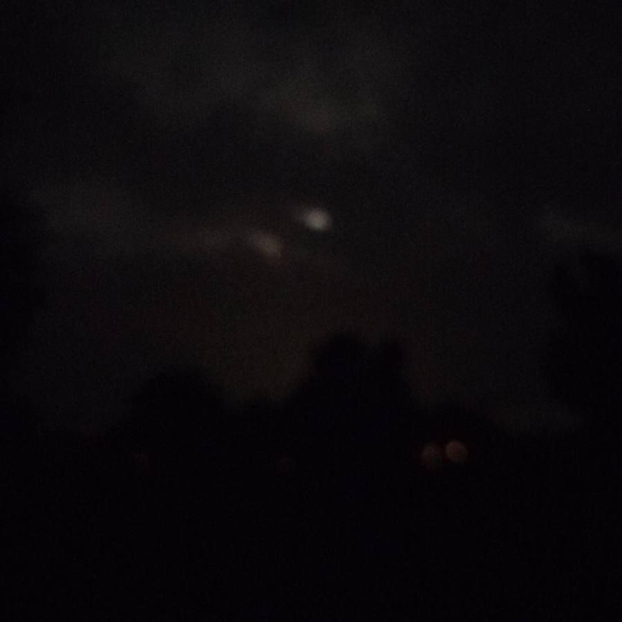
Image 1 — June 2, 2026
Blurry, but the luminous orb and companion elongated glow are visible in the cloud structure. No storm activity in the area at time of capture.
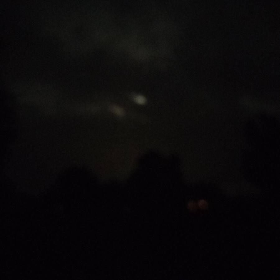
Image 2 — Seconds later
Same phenomenon, slightly shifted. Notice the cloud structures surrounding the lights. The two small warm lights at lower right are houses on the ground.
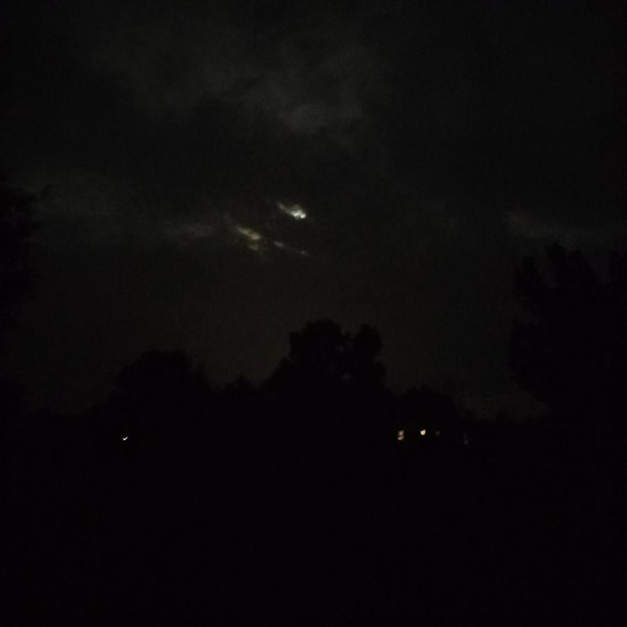
Image 3 — Clearest capture
Clouds moved slightly, making this the most distinct image. The lights in the sky are NOT typical lightning. After this photo was taken, one second later, they were gone. House lights remain visible at lower right for comparison.
Atmospheric Electrical Activity — May 28, 2026
This photograph documents the unusual cloud formation captured days before the earthquake lights and the Philippines event. The layered, charged structure of these clouds is one of the atmospheric indicators in the pre-formation detection framework.
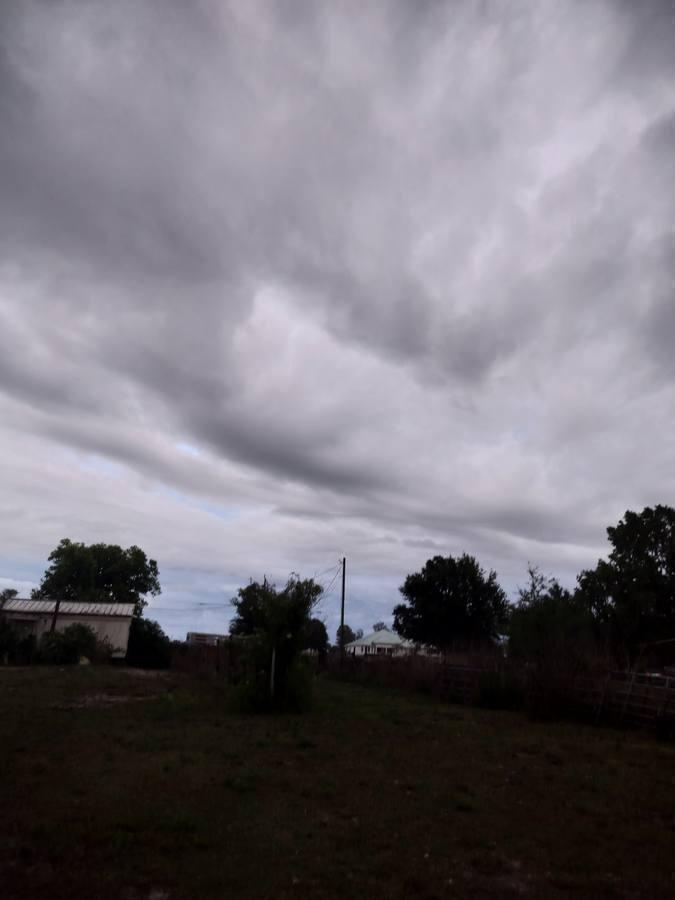
May 28, 2026 — Central Florida
Layered cloud formations showing the electrical charge structure that precedes major atmospheric and seismic events. Photographed from the farm looking southeast.
Biological Indicator — Barn Web, June 2026
The barn web above the chicken coop serves as a binary hurricane indicator. It is unoccupied at baseline. When spiders move in and build, a significant storm system is brewing. These structures did not exist before mid-May 2026, appearing weeks before any official tropical activity was detected.

Early June 2026 — Close-up through wire
Initial barn web occupation documented through the chicken wire. Spiders are moving webs out of harm's way, a behavior that does not occur outside pre-storm conditions.
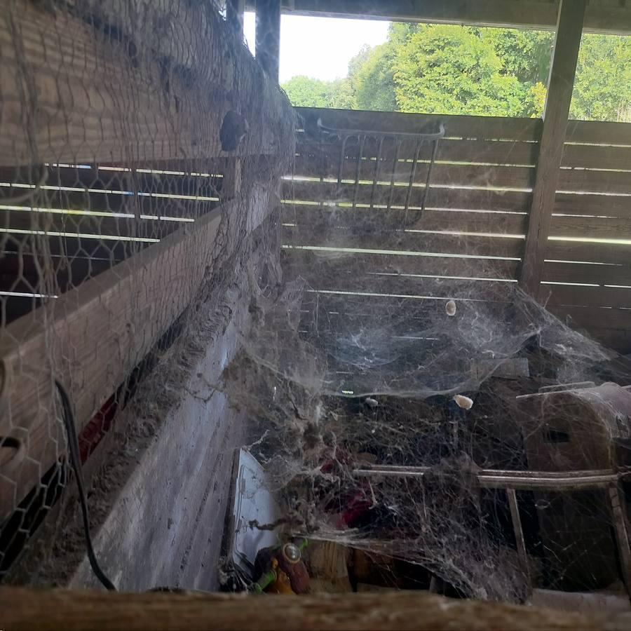
June 2026 — Full barn view
The scale of the web construction is clear here. Multiple large webs spanning the interior, with egg sacs visible. This level of activity is the confirmed hurricane signal. It was not present in April or early May.
Hurricane Prediction Evidence — June 2026
Exhibits A, F, G, and I document the evidence used in the June 2026 Atlantic hurricane season prediction. Exhibit A is the NOAA Week 2–3 Tropical Cyclone Formation Probability Map issued June 9, 2026 by Forecaster Allgood, showing elevated formation probability for the Atlantic basin. Exhibit F is satellite imagery of the West African convective complex dated June 9, 2026, the moisture source for Atlantic development. Exhibit G is Caribbean basin satellite radar from June 8, 2026, showing early basin organization. Exhibit I is the NHC Graphical Tropical Weather Outlook from June 19, 2026, confirming all three predicted formation elements were identified.
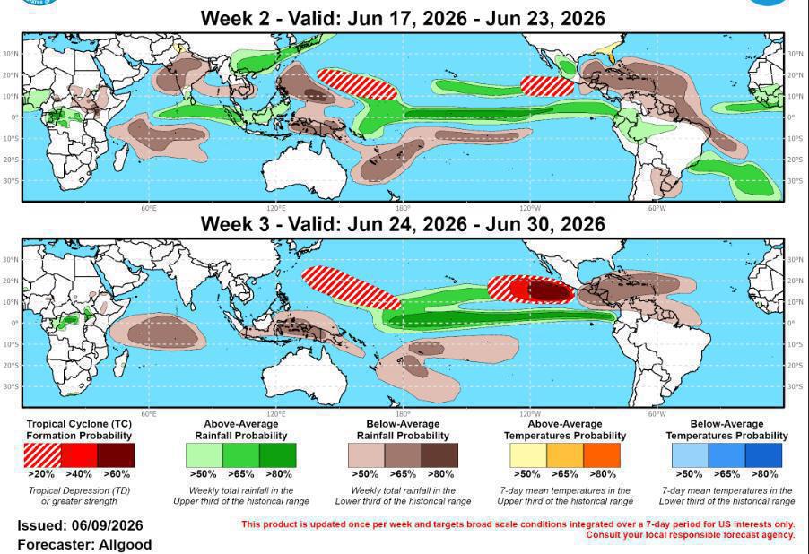 Exhibit A: NOAA Week 2–3 TC Formation Probability Map, June 9, 2026. Forecaster Allgood. Source: NOAA NHC.
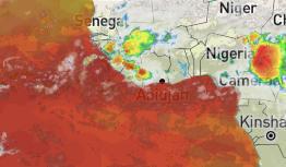 Exhibit F: West Africa convective complex, satellite imagery, June 9, 2026. Atlantic moisture source. Source: Satellite imagery.
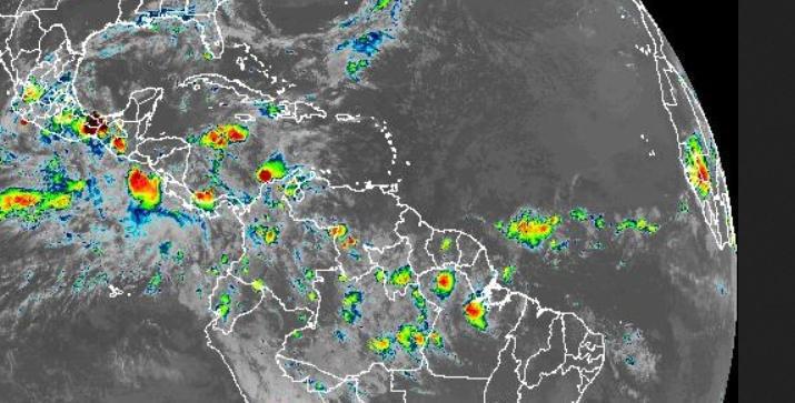 Exhibit G: Caribbean basin satellite radar, June 8, 2026 at 23:59 UTC. Source: Satellite radar.
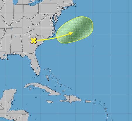 Exhibit I: NHC Graphical Tropical Weather Outlook, June 19, 2026. All three predicted formation elements confirmed. Source: NHC.
 Atmospheric Observation — June 7, 2023 | Hurricane Ian Historical Record — 2022
Exhibit B documents anomalous sky coloration photographed at the Polk County farm on June 7, 2023 at 8:31 PM — the same date Kilauea erupted after a three-month pause and an M4.8 struck Maubin, Myanmar, killing three people. Eight days later an M7.2 struck the Tonga-Fiji corridor. Exhibit C is the Hurricane Ian storm track screenshot from September 27, 2022, the day before Ian made Category 4 landfall near Cayo Costa, Florida with 150 mph sustained winds. Dogs, cats, and horses were all highly nervous prior to the landfall. Pacing began days before. All animals refused to go out or stay around the barn. Skies were documented and precursors were saved. Exhibit I shows a system days after it was called by the researcher, showing up exactly where it was expected - NE of Central Fl off the coast, heading in the direction of Ireland.
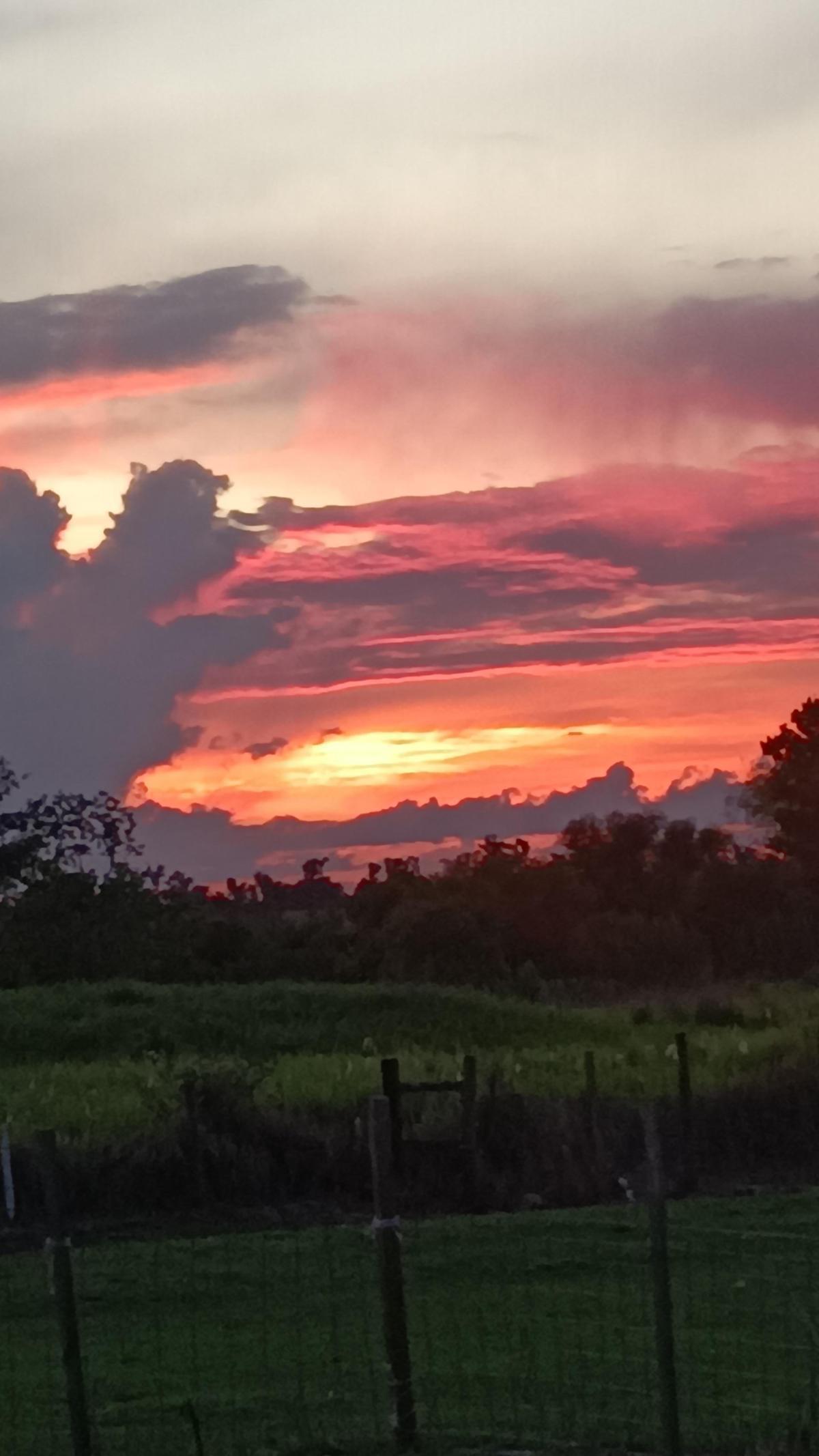 Exhibit B: Anomalous sky coloration, Polk County Florida farm, June 7, 2023 at 8:31 PM. Same date as Kilauea eruption and Myanmar M4.8. Source: Observer photograph.
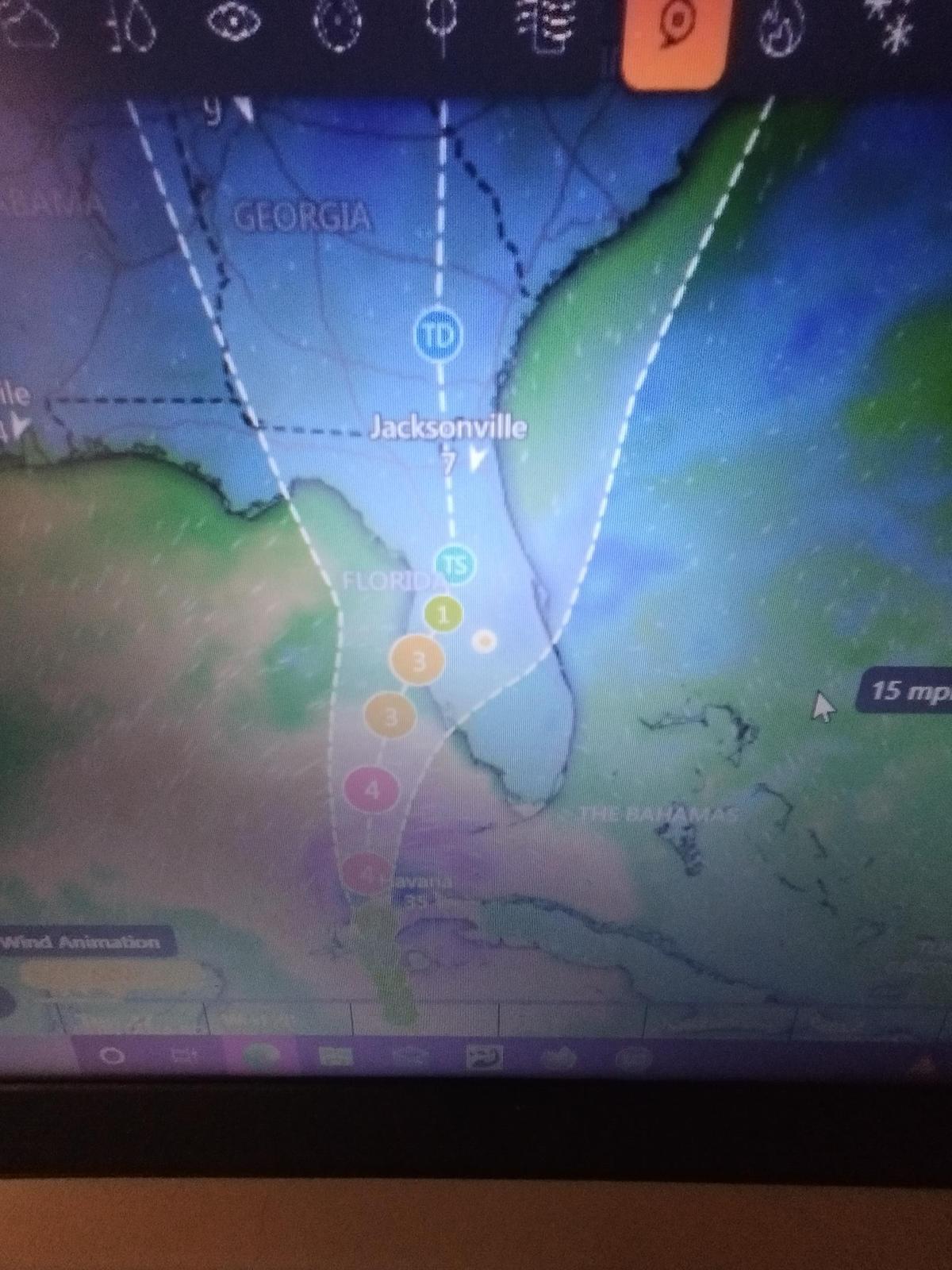 Exhibit C: Hurricane Ian storm track, September 27, 2022. Category 4 landfall September 28, 2022. Source: Observer screenshot.
 Biological Indicator — Ant Mass Evacuation, June 4, 2026
Exhibit E is the researcher’s own documentation from the Polk County rescue farm, June 4, 2026 at 21:14 — four days before the Philippines M7.8 and Cuba M6.1. This confirms two-continent corroboration of the same pre-seismic biological response: the China mass evacuation (documented in the Biological Indicator section above) and the researcher’s independent observation occurring during the same window.
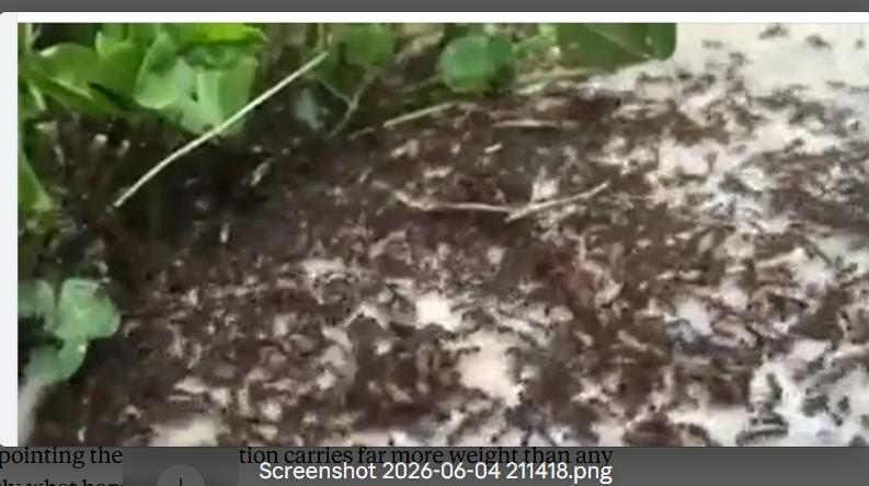 Exhibit E: Ant mass evacuation documentation, June 4, 2026 at 21:14. Four days before Philippines M7.8 and Cuba M6.1. Source: Observer documentation.
 Dual Seismic Event Documentation — June 8, 2026 | Philippines M7.8 & Cuba M6.1
This Google Maps screenshot documents both the Philippines M7.8 (blue marker) and Cuba M6.1 (red marker) occurring on the same calendar date on opposite sides of the Pacific. Both were predicted in advance from the farm. The simultaneous occurrence on two separate tectonic systems represents the most significant single-day confirmation in this record. Researcher stated that one would be in Cuba and the other significantly southwest of it. Both would be larger and another one would show up soon, but not on the known plate boundaries. All were confirmed incidents.
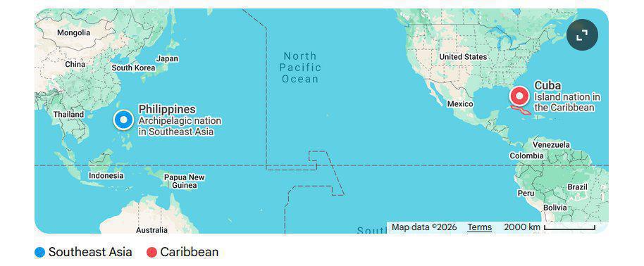 Exhibit H: Philippines M7.8 and Cuba M6.1 geographic documentation, June 8, 2026. Blue marker: Philippines. Red marker: Cuba. Source: Observer screenshot.
 Biological Indicator — Antlion Pit Array, Polk County Florida, June 24, 2026
These three photographs document antlion survival chamber excavation at the researcher’s Polk County property on June 24, 2026. Behavior onset was documented approximately May 7, 2026, representing a four-week lead time before the June 2026 tropical activity. Antlions excavate survival chambers when they sense sustained vibration and atmospheric pressure change consistent with incoming storm systems. The density, clustering, and distribution of the pits are the relevant signals.
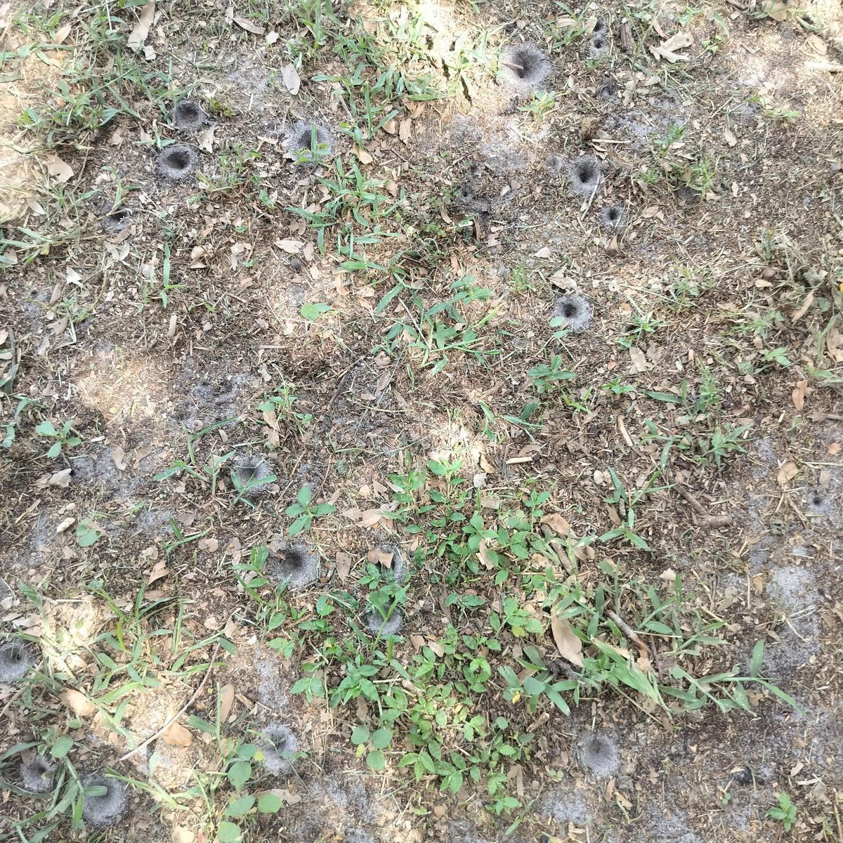 Exhibit J-1: Antlion pit array, Polk County Florida, June 24, 2026. Dense distribution pattern. Source: Observer photograph.
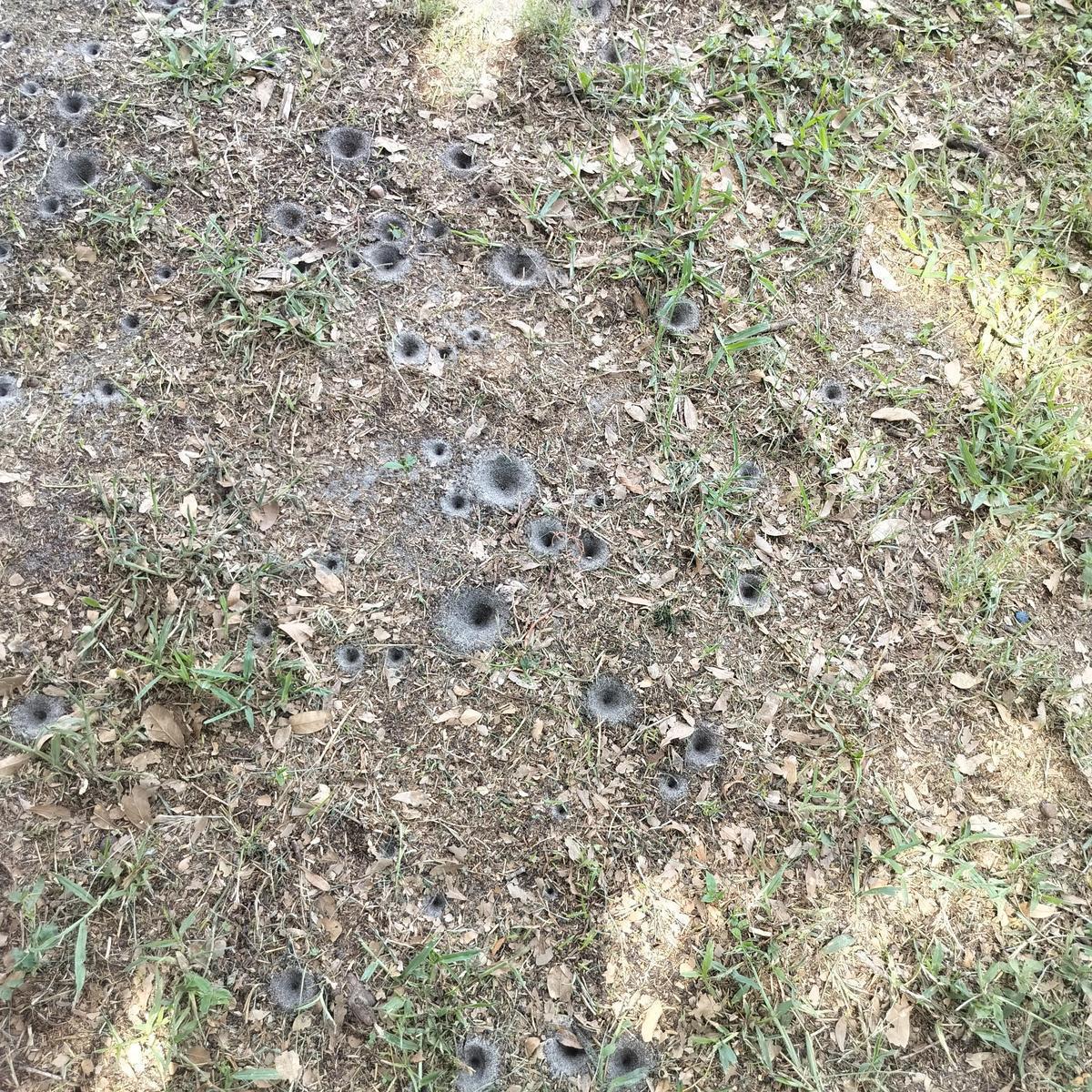 Exhibit J-2: Antlion pit array, Polk County Florida, June 24, 2026. Clustering pattern. Source: Observer photograph.
 Exhibit J-3: Antlion pit array, Polk County Florida, June 24, 2026. Blue marker flags for scale. Source: Observer photograph.
 Atmospheric Observation — Venus-Moon Conjunction, June 17–18, 2026
These photographs show the crescent moon paired with Venus in the western sky over Polk County on the night of June 17-18, 2026. A secondary luminous element is visible in both images. The researcher photographed the phenomena first, then independently consulted NOAA’s Space Weather Prediction Center, finding solar wind peaking at 509 km/s and a hemispheric power index of 20.7 GW. No specific earthquake is attached to this observation. It is documented as an independent atmospheric observation corroborated after the fact by NOAA data.
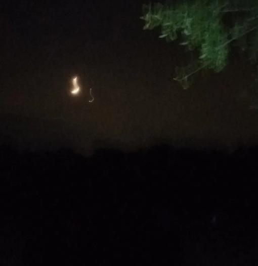 Exhibit L-1: Venus-moon conjunction, Polk County Florida, June 17-18, 2026. Crescent moon with Venus and secondary luminous element. Source: Observer photograph.
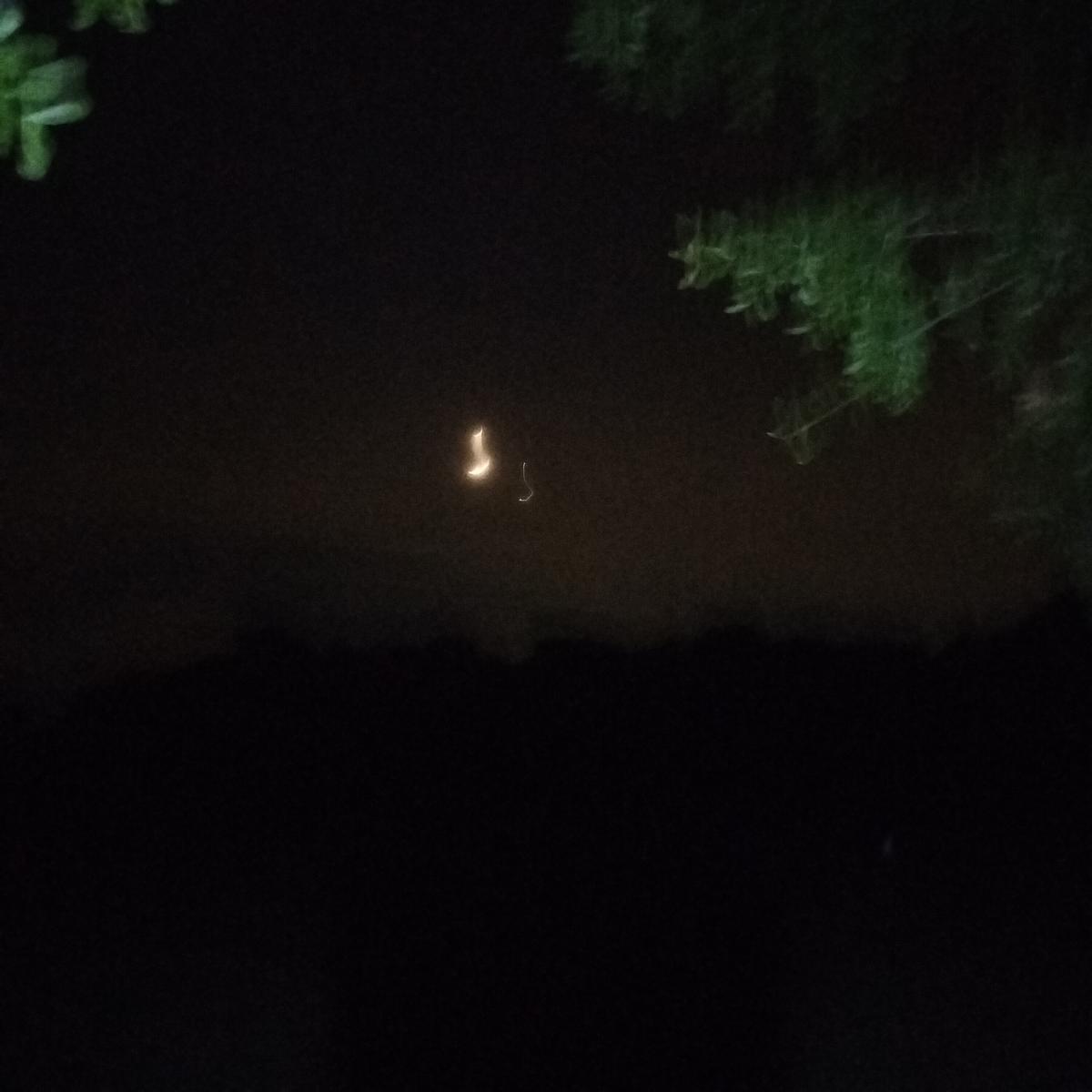 Exhibit L-2: Venus-moon conjunction, Polk County Florida, June 17-18, 2026. Green tree foliage visible upper right. Source: Observer photograph.
 NOAA Space Weather Documentation — June 17–18, 2026
Four screenshots from the NOAA Space Weather Prediction Center captured June 17-18, 2026, confirming elevated solar activity the same night the researcher photographed the Venus-moon conjunction. Solar wind peaked at 509 km/s, total IMF reached 12 nT, the hemispheric power index was 20.7 GW with the auroral oval extending into mid-latitudes, and electrons above 2 MeV reached 1,012 pfu. The researcher consulted NOAA independently after photographing the phenomena — observation first, data second. Source: NOAA SWPC.
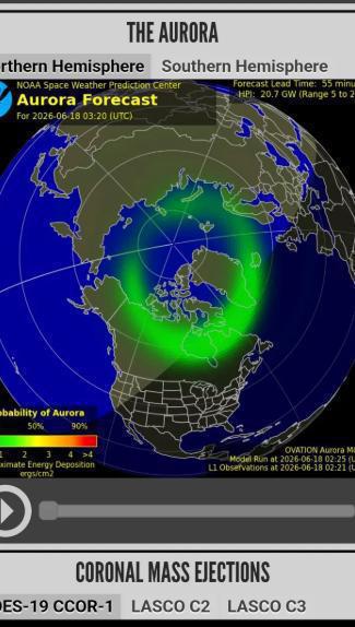 Exhibit M-1: NOAA Aurora Forecast, June 18, 2026 at 03:20 UTC. HPI 20.7 GW. Auroral oval extending into mid-latitudes. Source: NOAA SWPC OVATION Model.
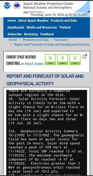 Exhibit M-2: NOAA SWPC Report, June 18, 2026 at 02:36 UTC. Solar wind peaked 509 km/s. Total IMF 12 nT. Electrons >2 MeV: 1,012 pfu. Source: NOAA SWPC.
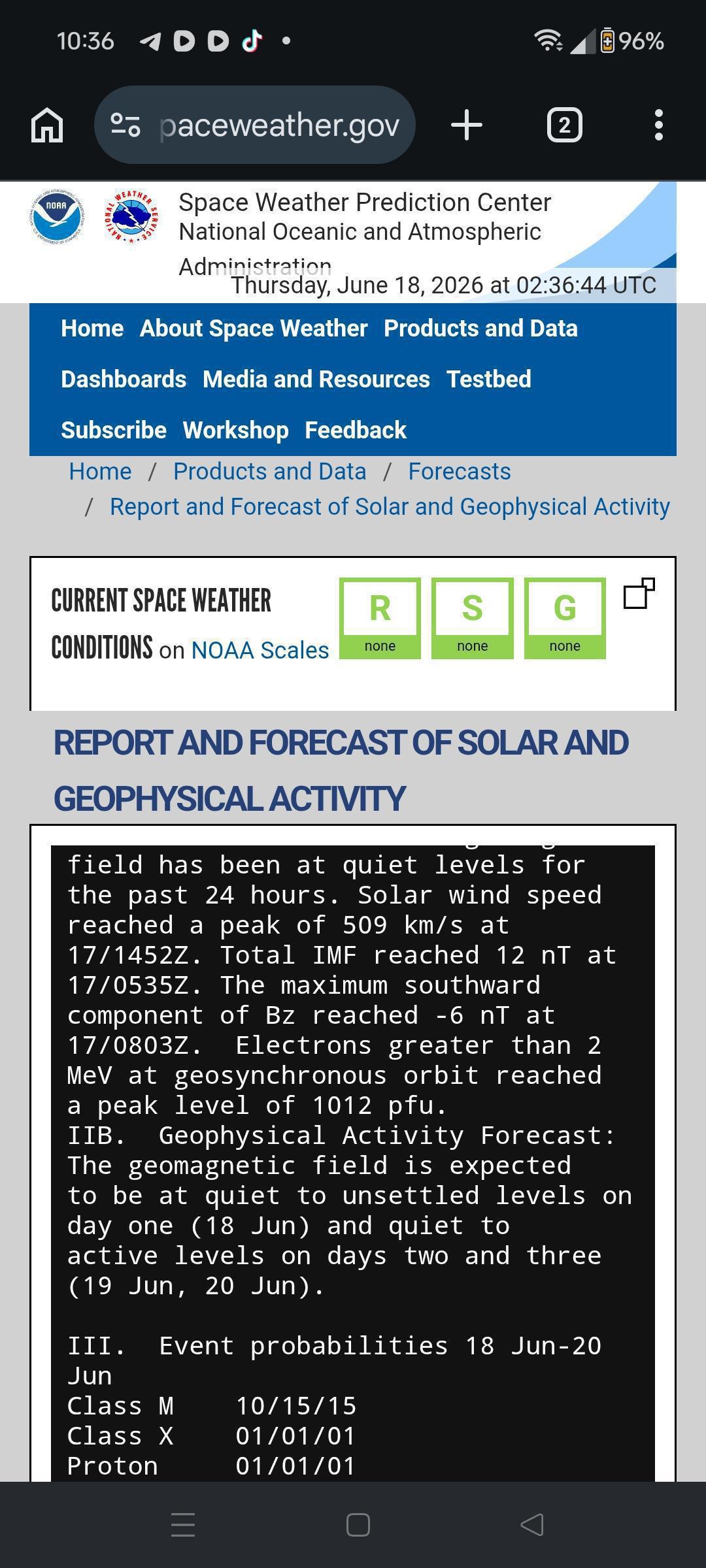 Exhibit M-4: NOAA SWPC Event Probabilities June 18-20, 2026. M-class flare probability 10/15/15%. Source: NOAA SWPC.
 Seismic Confirmation — M4.8 Maubin, Myanmar, June 7, 2023
Wikipedia entry confirming three fatalities from the M4.8 earthquake in Maubin, Ayeyarwady Region, Myanmar, June 7, 2023. Independently confirmed by USGS at 09:53 UTC, epicenter 16.873N, 95.553E, depth 10 km. This event occurred on the same date as the Kilauea eruption and the anomalous sky coloration documented in Exhibit B.
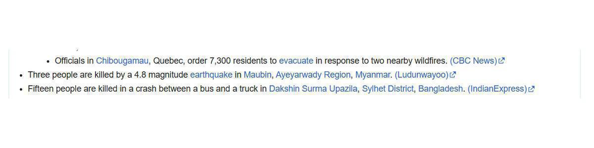
Exhibit N: Wikipedia confirmation of M4.8 Maubin Myanmar earthquake, three fatalities, June 7, 2023. Source: Wikipedia via observer screenshot.
An Honest Note on Accuracy
Accuracy as of June 25, 2026:22 confirmed predictions. 0 confirmed misses. 1 pending confirmation.No predictive system, human or instrumented, can perfectly account for every real-time variable. Sudden heat injection from a solar event, unexpected pressure transfer between adjacent systems, or ocean temperature shifts can move a projected path by a small margin. This framework has strong accuracy on event type, location region, and timing window. Precise coordinates and exact timing carry normal variance expected of any long-lead prediction. When conditions hold stable, a system follows its projected path.
Sources & Citations
USGS / Hawaiian Volcano Observatory. Kilauea Episodes 36 and 37. November–December 2025.
usgs.gov/hvo
USGS / Hawaiian Volcano Observatory. Kilauea June 7, 2023 eruption after three-month pause.
hawaiipublicradio.org
EarthquakeTrack.com (USGS data). M4.8 Maubin Ayeyarwady Myanmar June 7, 2023 at 09:53 UTC.
earthquaketrack.com
VolcanoDiscovery. M7.2 South Pacific Ocean Tonga-Fiji corridor June 15–16, 2023.
volcanodiscovery.com
NOAA Space Weather Prediction Center. CME and solar activity documentation, June 2026.
swpc.noaa.gov
ESA Swarm Mission / Finlay et al. South Atlantic Anomaly expansion. Physics of the Earth and Planetary Interiors, 2025.
esa.int
EarthquakeTrack.com (USGS data). M5.1 Yap State Micronesia June 23, 2026; M5.1 Kermadec Islands June 22, 2026; M4.7
South Pacific June 22, 2026. earthquaketrack.com
South Pacific June 22, 2026. earthquaketrack.com
Frohlich, C. Can fish detect seismic waves? Geophysical Research Letters, 7(8), 1980.
agupubs.onlinelibrary.wiley.com
Kirschvink, J.L. Earthquake Prediction by Animals. Bulletin of the Seismological Society of America, 90, 2000.
caltech.edu
Freund et al. Ground Water Chemistry and Animal Behavior Before Earthquakes. PMC/NIH.
ncbi.nlm.nih.gov
Wegrzyn et al. Black Sea cetacean mortality study. Royal Society Biology Letters. Newsweek April 2023.
newsweek.com
University of Florida IFAS. Introduced Monkey Populations of Florida. Anderson et al., 2022.
ifas.ufl.edu
Harvard Center for Astrophysics / EarthSky.org / BBC Sky at Night Magazine. Venus-Moon lunar occultation June 17, 2026.
cfa.harvard.edu
Euronews / Associated Press. M6.7 earthquake Central Sulawesi Indonesia, Palu. June 16, 2026.
euronews.com
Space.com / Spaceflight Now. SpaceX Falcon 9 Starlink 6-78 launch. November 20, 2025 at 10:39 PM EST.
space.com
Claude.ai session archive. Natural Signs prediction and confirmation sessions, October 2025 through June 2026.
Available on request from researcher.
Available on request from researcher.